Approaching Amarillo, we had to make a decision. A small cell struggling toward us from near Friona was the most convenient target, but it was failing to take on supercell structure. Its updraft was visibly anemic as it came into view. The most obviously established storm was far to the northwest near Hartley, a messy beast of a supercell that kept producing 65-70 dBZ cores. It was ingesting convection that had initiated to its south and would soon have clear inflow. At the urging of an off-duty SPC forecaster who was texting us, we accepted the extra miles and hit Route 287 north to intercept the dominant supercell. After clearing a string of badly timed stoplights in Dumas, we closed on a spectacular storm near Stratford, Texas. It was just hitting its stride after ingesting the last interfering cell to its south, and its inflow flirted with severe criteria as it blasted us with dust and tumbleweeds.


We stayed just south of the forward flank and rolled into Stratford amid a thick cloud of dust and swarms of tumbleweeds. Turning northeast and leaving town on Route 54, we stopped to see if we could make out any features of the updraft base, but the dust obscured everything. We jogged a few more miles east to be sure we were clear of the north-northeastward-moving storm's path, then headed north into a maze of grid roads.
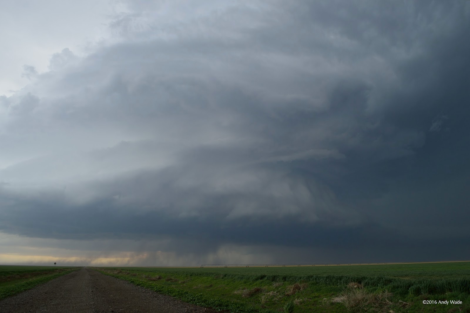
The storm was nearly featureless for some time after that as we navigated into the Oklahoma Panhandle on back roads, finally finding a dirt road of reasonable quality on which to follow the storm north. Then everything changed in a few seconds. We came out of a low spot on the road and suddenly there was a small light gray tornado far to the northwest.

The tornado was gone in under a minute and we kept pursuing the storm. The updraft got a bit closer to our northward route and soon dropped a second brief tornado. Again it was gone before anyone had time to set up and get off a really good photo.

With daylight waning, we went east on Route 412 near Eva and north again on another dirt road. The map showed it crossing the Beaver River, but beyond a cattle guard it looked impassable and we stopped. On cue, the storm produced another tornado in the distance behind a large clear slot, with possibly a second funnel wrapping around it for a moment.


This was the end of the road for us. We watched the storm begin cycling again as it faded to the north. Then we dropped back to Route 412 and started the long trip back to Norman. These were the first Oklahoma tornadoes I'd seen since a power flash in some swirling rain under a wall cloud near Sterling, OK on April 17, 2013.
No comments:
Post a Comment