Sunday, May 15, 2016

One week in May

Sunday, May 8

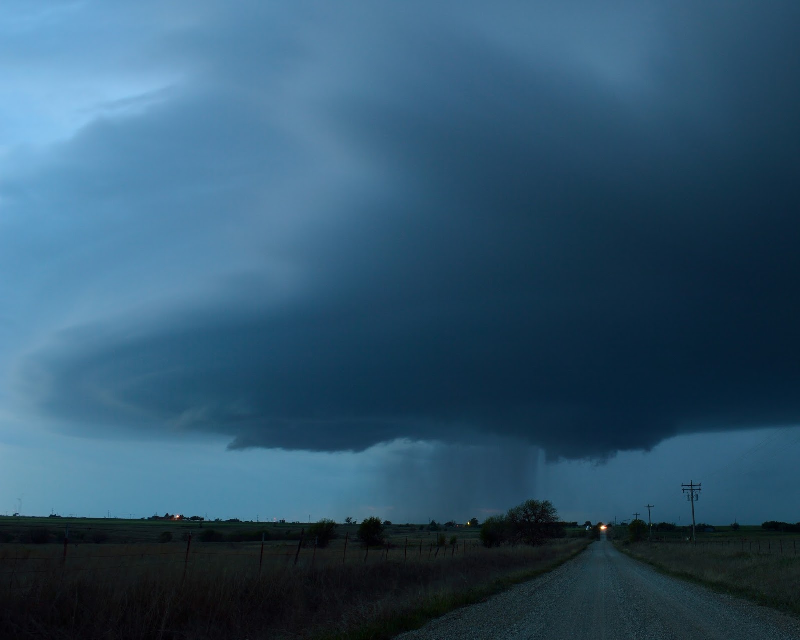
In elementary or middle school, my class read excerpts from Kiowa author N. Scott Momaday's The Way to Rainy Mountain.  I don't know why I remember that, but that same Rainy Mountain--not really a mountain at all--poked up over the farmland to our south-southwest as we launched a balloon north of Gotebo, Oklahoma.  Storms had erupted off the dryline in the western part of the state and up into Kansas.  Without enough low-level directional shear for the storms' induced pressure perturbation fields to favor right-moving supercells, they began splitting.  A couple left-movers became dominant, including a visually impressive one to the south.


Left-movers are notorious hailers.  We bailed east and south out of the left split's baseball hail swath, trying to get into the inflow of the lone healthy right-mover within striking distance.  The other crew had started farther south and made it south of the storm near Lawton, but we found ourselves coming in on the north side of the hail core.  We rolled slowly through Lawton on I-44 and had to stop a couple times in half-dollar hail and zero visibility.  We turned east on Hwy 7 in heavy rain and intermittent small hail with strong rear-flank downdraft winds throwing leaves and twigs all over the road.  At Hwy 65, our last reliable south option for over 10 miles, we were given a green light to continue east and possibly break out of the precip.


Radar showed a tight mesocyclone moving dangerously toward Hwy 7 ahead of us.  Still unable to see any features of the storm in driving rain, we decided against going farther and dove south through the hook.  Minutes later, there was a small, weak tornado just a mile or two south of Hwy 7 near where we would've been.  We would likely have had an ideal view of it.  But continuing between the precip core and a possible tornado, without visibility, is asking for trouble; the tornado could just as easily have been on the road and hidden in rain.  The mobile mesonet dataset we collected in the core and RFD leading up to tornadogenesis is probably valuable in its own right.  There are always other storms--and we had no idea how soon.

Monday, May 9

When we got the chat message to turn around and come back north after launching a 3 p.m. weather balloon behind a gas station at the Marietta, Oklahoma I-35 interchange, I had never seen a killer tornado.  The dozen or so I'd encountered were weak, brief whirls over open country, except for a couple that did damage near Pampa last November.  I was fine with that.

As we headed north, our sounding showed strong convective instability and more than sufficient deep-layer shear for supercells.  Storm-relative helicity was lacking at our location near the Red River, but the sounding crew a county or two to the north reported a sickle-shaped hodograph supportive of strong tornadoes.  Our target was a blip of reflectivity that had been floundering northeastward from the dryline near Duncan.  We were thinking towers to our south on the opposite side of the river looked more robust.  That was our own bias (though the Gainesville cell did go on to produce tornadoes in the Red River Valley).  We just wanted to punch through to the south side of a maturing supercell.  Instead, we rolled up I-35, wondering if the fuzzy anvil in the distance would survive or if we'd be going home empty-handed.

By the time we closed in on our next launch site, a hilltop east of Springer sprinkled with rain from a struggling cell just south, we realized the storm was going to do more than survive.


Successive distinct fingers of reflectivity appeared along the storm's southern flank and slid northward, congealing into an organized precipitation core.  That's how the 2013 Moore storm evolved just after initiation.  The similarities didn't stop there.  As we turned north on Route 177 near Gene Autry, the other crew was watching a violent, highly visible cone tornado doing damage in Katie.  Our next assignment came in:  Mill Creek, back to our southeast and away from the storm.  We had two choices to get there in time.  We could double back to an obscure road of unknown quality that led directly east to Mill Creek.  Or we could continue north into Sulphur, jog east on Hwy 7--maybe seeing the tornado--and drop south into Mill Creek on Hwy 1.  Easy call.  We caught a split-second glimpse of a high-contrast stovepipe tornado with a large debris cloud between stands of trees in the rolling, forested terrain south of Sulphur and flew into town.

Finally we emerged from Sulphur, where dozens of locals stood on street corners staring at the sky, onto a hill overlooking town.  Several chasers and the other NSSL crew were there.  We parked on the shoulder.  I switched on my camera, jumped out, ran across the road, and got exactly one shot of the Katie tornado fully condensed in the distance.


The funnel lingered halfway to the ground for several minutes longer, but that was the end.  We were just about to launch a balloon from that site when we realized the storm to the south was intensifying and sliding north toward our supercell, taking its developing mesocyclone directly over us.  We had to dodge west and south away from the storm as it was clearly about to tornado again.

Our van stopped several miles south of Sulphur and, with a local man excitedly showing us the video he'd just shot, we attempted another launch.  That sonde promptly got ingested by the massive storm (now producing a wedge tornado) and stopped transmitting in midlevels.  Mill Creek became our target again, and we decided to get there the same way we'd tried to get there before.  On the hill east of Sulphur, this time there was no chance of seeing the large tornado through the rain wrapping around the south side.  The only view was to the tornado's east, and that was directly out of our way.  We reluctantly turned south toward Mill Creek.

We were closing in on the town when a sunlit funnel or tornado suddenly appeared in the back side of a new supercell due east of us.  Open views are nearly impossible to find in southeastern Oklahoma, so we settled for a field where we could see all but the lowest part of the funnel.  We ran up to the fence and started taking photos.  I wasn't sure if there wasn't a tornado warning yet or if Radarscope just hadn't shown it because of our spotty cell service, but I called NWS Norman.  They seemed to know about it.


Then we launched near Mill Creek, sped eastward behind the southern storm, and put up a final sonde near Atoka as that storm dissipated.

After further review, the sunlit tornado wasn't the EF3 Connerville-Bromide tornado as we and the NWS had originally thought.  This was a freakish circulation hanging off the west side of the cluster, between the Sulphur and Bromide storms, weak and barely detectable by radar.  KFOR chopper video showed it on the ground toward the end of my series of photos, but it may or may not have been down at the beginning.  The path was never surveyed.

I made three stupid storm reporting mistakes that I won't make again.  First, I didn't even think to call it in until a couple minutes had elapsed.  (As it turned out, this tornado didn't hit anything and the deadly one to the south was warned a couple minutes before my call, so it didn't make a difference, but it could have.)  Second, I didn't nail down the location of the possible tornado, going along with NWS Norman's understandable but wrong assumption that it was on the next storm south.  Third, I reported a tornado without confirming that it extended all the way to the ground, even though I've never seen a funnel get so close for so long without making it.

Later, we found out the EF4 Katie tornado had killed an elderly man toward the end of its path, which is hard to fathom because every local TV station was carrying a spectacular live stream and at least some were simulcasting on radio.  The skinny little tornado we saw from miles away was the worst thing that ever happened to someone.  Everyone in the weather community deals with that differently, but for now, I don't want that one hanging on the wall.

Wednesday, May 11

Wednesday wasn't a supercell day and we didn't operate, but a boundary draped across central Oklahoma kicked off some nocturnal storms that produced CG lightning in south Norman.  The thunder from this one was an immediate crack.


Friday, May 13

Mini-MPEX passed on Friday, a marginal and somewhat unorthodox setup for the middle of May with a narrow window for high-based supercells ahead of a cold front.  By midday, the HRRR locked onto a small target area at the far southwestern corner of Oklahoma.  I made for Hollis, the last town before Texas on Route 62 out of Altus, and stopped on the north side of town just in time for the show.  A few other chasers were scattered around the storm, but I saw none within a mile of my spot.  That's rare for a kicking supercell in May on the Plains even with tornado probabilities near zero.

The storm was evolving from a small multicell cluster into an intense right-moving supercell as it came into view.  At times the lightning in the forward flank had so many return strokes I could hit the camera button when I saw a flash and still capture the last few strokes.


As I headed south to get back ahead of the storm, which was taking a hard right toward the Red River, a thin laminar cloud appeared near the updraft base right before I lost sight of it in Hollis.  Having just seen dust blasting south in outflow near that spot, I couldn't believe it was a tornado, but I cut back west to make sure.  Nothing was there.  A Warning Decision Training Branch scientist who saw it tweeted that it could've been a small rope, but nobody confirmed it and the official count for the day remains 0 tornadoes.

A new core had appeared almost directly over Hollis, and I raced east out of town in 50 dBZ big drops and what sounded like a couple small hailstones.  For the next hour of escaping south into Texas, Verizon data was nonexistent.  I wound up in Crowell before it magically reappeared.  The supercell had faded after diving west of Hollis and was growing upscale.  Showing a little shelfy structure, it came close enough for some sunset lightning shots that don't approach doing justice to the anvil crawlers overhead.


Sunday, April 24, 2016

9-10 April 2016: A hike and a supercell

A couple weeks ago I made my second trip to McGee Creek Natural Scenic Recreation Area near Lane, Oklahoma.  To get there from Norman, you drive southeast for about two and a half hours.  Build in extra time if you plan to purchase a large Confederate flag from the roadside vendor.  Then you take a left off Highway 3 onto Centerpoint Road.  Centerpoint Road begins smoothly enough, but the pavement becomes intermittent for the last few miles.  Cell service fades.  The road turns to a washboard and, guessing from the size of the fences, passes through a small dinosaur ranch.

The park office is at the entrance, and visitors are required to stop and fill out a use permit.  Only a certain number of permits are allotted per day, but I can't imagine that number ever being reached.  The yellow carbon copy goes in a box at the station when you enter; the important lines are the time you expect to return and the trail on which you'll start.  The white copy stays with you while you're out and goes in an adjacent box when you make it back.  A ranger in pajama pants (I didn't know about this career option) was advising a couple with Missouri plates on where to camp and how to get there.  The young woman looked thoroughly out of her element.  She was asking something about how to get their gear to the campsite and seemed to be under the impression they could drive to it.  Nothing about her demeanor said, "Tonight I'm going to dig a hole in the woods and poop in it."  I hope she knew about that particular feature of the backcountry campsites because I can't describe her face for a sketch artist if they find his body.

With a trace of rain falling, I started on the Rocky Point trail.  It's rocky and pointy.  With steep switchbacks around rugged, lichen-covered boulders immersed in fresh lime green foliage, it's also the antithesis of what people who've never been to Oklahoma believe Oklahoma to be. 


Rocky Point dumps you onto the Little Bugaboo trail.  Little Bugaboo fords and then loosely follows Little Bugaboo Creek.  Last year the waterfalls there were the highlight of the trip, but this time the creek was reduced to a trickle between sluggish, pollen-filmed puddles.  


At least four Oklahoma towns host rattlesnake roundups in the month of April.  While all of those towns are on the other side of I-35, McGee Creek still falls squarely in the range and preferred habitat of the timber rattlesnake, western pygmy rattlesnake, and copperhead.  Western diamondbacks and cottonmouths also aren't out of the question.  The trail map I'd picked up at the office advised carrying a snakebite kit, advice I was obeying exactly as well as the advice to not hike alone.  Considering all that and the disappointing state of the creek, I skipped the scramble down the rocks to the waterfalls.

 
From that point onward, the trails lead directly away from the park office into the wilderness.  Little Bugaboo ends at an intersection with South Rim.  Literature about the trail system says that South Rim and some of the other more distant trails were once "Jeep roads."  An ancient truck fender that serves as a landmark proves that someone, sometime, did indeed drive out there.  In the past the road must have been better maintained--or maybe it wasn't and that's why there's a chunk of a truck.

I went on into territory I hadn't seen on the last trip.  The North Rim trail bends back westward on the far side of the valley.  Robert Frost took the road less traveled once; if he'd done it a dozen times, he might have stumbled onto North Rim.  In terms of absolute distance to civilization, it's actually not so remote--less than ten miles east is the Indian Nation Turnpike, and it's still just a few easy miles back to the park office.  But except for the trail itself, traces of human existence are extremely scant.  So far the only people I'd seen along the trail were at a campsite near the end of Little Bugaboo.  I like solitude.  North Rim was a lot of it even for me.  With increasing isolation came uneasiness at the number and magnitude of things that could go wrong, realistic or not.  (Remember the part about the snakes?)


It was almost time to turn around when I came to the head of the Wildcat Canyon trail.  "Wildcat Canyon" sounded so much more thrilling than "Little Bugaboo" or "South Rim" or "North Rim" that I just had to see what it was about.  There were no wildcats and no canyon, and I'm not sure what I thought I was going to do if I encountered either.


Hiking out was an adventure, especially after passing the end of last year's trek.  Hiking back was an exhausting slog with an eye on the clock, a long drive looming, and a very rumbly stomach.  A phone app would later estimate that the round trip took 2290 Calories, which is a whole lot more granola bars than I'd stuffed in my little gym bag.  Lots of people run this distance without stopping.  I have no idea how or why.


Spotting a better overlook than the marked one off South Rim, I ventured out onto it for a moment.  An "overlook" at McGee Creek is a place to peek through some nearby trees at some other trees farther away.  A couple of guys hacking noisily through the woods down below made for human contact #2 in some eight miles of walking.


Back at the parking lot my boots, which were not at all green before, were caked with a lifetime supply of sneezes.


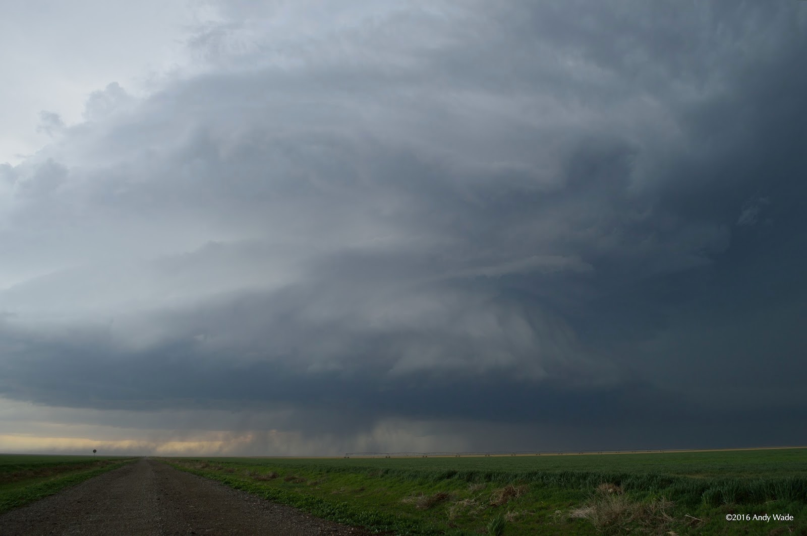
I was happy to have seen twelve miles and change of brilliant springtime Oklahoma, pollen and all.  But spring scenery around here is not limited to ground level.  The next day was a Sunday, and with modest storms ongoing in southwestern Oklahoma, I left Norman after church in the evening.  It was a race against the setting sun to a supercell that had separated itself from messy convection and was passing north of Walters.  I approached along the forward flank with daylight left and inflow streaming in overhead.  The storm was somewhat high-based and deep laminar layers at the base of the updraft, though visually attractive, suggested stabilization with nocturnal cooling.  Other chasers farther south had much better views of the stacked-plates structure.  The view from the east was all I could get with darkness falling, and it wasn't bad.


Monday, April 18, 2016

15 April 2016 Panhandle tornadic supercell

I never planned to chase Friday, April 15.  In the morning we were making final preparations on the NSSL vans newly outfitted for mobile sounding launches this spring.  I was supposed to have a meeting at 1:00, but wound up being free just after noon with severe weather potential quickly trending up in the Texas Panhandle.  SPC had bumped the Day 1 up to Enhanced.  A few texts later we had a full load of four SoM grad students.  We departed Norman a little later than we should have, around 1:30, and made for Amarillo on I-40.  Storms fired on the dryline well before we crossed the state line.

Approaching Amarillo, we had to make a decision.  A small cell struggling toward us from near Friona was the most convenient target, but it was failing to take on supercell structure.  Its updraft was visibly anemic as it came into view.  The most obviously established storm was far to the northwest near Hartley, a messy beast of a supercell that kept producing 65-70 dBZ cores.  It was ingesting convection that had initiated to its south and would soon have clear inflow.  At the urging of an off-duty SPC forecaster who was texting us, we accepted the extra miles and hit Route 287 north to intercept the dominant supercell.  After clearing a string of badly timed stoplights in Dumas, we closed on a spectacular storm near Stratford, Texas.  It was just hitting its stride after ingesting the last interfering cell to its south, and its inflow flirted with severe criteria as it blasted us with dust and tumbleweeds.


We stayed just south of the forward flank and rolled into Stratford amid a thick cloud of dust and swarms of tumbleweeds.  Turning northeast and leaving town on Route 54, we stopped to see if we could make out any features of the updraft base, but the dust obscured everything.  We jogged a few more miles east to be sure we were clear of the north-northeastward-moving storm's path, then headed north into a maze of grid roads.

The storm was nearly featureless for some time after that as we navigated into the Oklahoma Panhandle on back roads, finally finding a dirt road of reasonable quality on which to follow the storm north.  Then everything changed in a few seconds.  We came out of a low spot on the road and suddenly there was a small light gray tornado far to the northwest.


The tornado was gone in under a minute and we kept pursuing the storm.  The updraft got a bit closer to our northward route and soon dropped a second brief tornado.  Again it was gone before anyone had time to set up and get off a really good photo.


With daylight waning, we went east on Route 412 near Eva and north again on another dirt road.  The map showed it crossing the Beaver River, but beyond a cattle guard it looked impassable and we stopped.  On cue, the storm produced another tornado in the distance behind a large clear slot, with possibly a second funnel wrapping around it for a moment.


This was the end of the road for us.  We watched the storm begin cycling again as it faded to the north.  Then we dropped back to Route 412 and started the long trip back to Norman.  These were the first Oklahoma tornadoes I'd seen since a power flash in some swirling rain under a wall cloud near Sterling, OK on April 17, 2013.

Tuesday, January 19, 2016

Late week Ohio Valley/Mid-Atlantic snowstorm

Thursday update:


Water vapor imagery shows the upper trough digging into the south-central U.S.

Winter storm warnings cover 52 of West Virginia's 55 counties (tip of Northern Panhandle excluded).  Major models have converged.  There's fairly high confidence in enough snow to make road travel extremely difficult or impossible and cause power outages.  Exact snowfall totals only matter so much beyond the point where everything shuts down, and much of the state can expect to reach that point.

The NAM has sharpened the temperature gradient at 700 mb (about 3 km above ground), focusing warm advection into a narrower band.  If this verifies, areas under that band of enhanced ascent will see snowfall rates pushing 2" per hour for several hours Friday night.  Plows and salt can't keep up with that.


Wednesday morning update:

Snow lovers rejoice!

NWS Charleston has covered all but the southernmost areas with a winter storm watch for 6"+ in the lower elevations and 12"+ in the mountains.  These are conservative, no-hype numbers.

Models are converging on the Euro's original idea of the surface low's track.  A more southerly track will mean less of a chance for other precip types to mix in.  There might still be brief intervals of sleet in southern WV, but the greatest ice accumulation should remain well south of the state.  This track brings ever so slightly colder air, such that a terrain-induced warm wedge west of the high elevations is less likely to take a big bite out of accumulations.  Furthermore, the track of the second surface cyclone up the Atlantic coast--the nor'easter--puts WV in a good place to catch wraparound snow on the back side all day Saturday.

Let's look at Weather Prediction Center probabilities...


I-64 corridor from Huntington to Charleston, that's a 50/50 shot at reaching a foot.


Original Tuesday morning post:

Take-home points:

1. Enough snowfall to make travel extremely difficult or impossible across most of West Virginia is looking more and more likely.  Forecast models are trending toward a storm comparable to the major snows of last winter.  Be prepared by Thursday evening.

2. Take forecasts of enormous snow totals with a grain of salt for the next 24 hours.  The big numbers being spewed out by some models are entirely possible, but there are a couple different ways the storm could realistically fail to produce accumulating snow for some of WV.

3. A relatively small swath of western/southwestern/central WV may see some ice accumulation.  A few power outages could result.

For specific point forecasts, NWS Charleston is here: http://www.weather.gov/rlx/.

Details:

West Virginia, the hype is more or less real.  Major models agree that heavy snow is likely for most of the state between Thursday night and Saturday morning.

However, we're 3-4 days out.  Forecasting a fast-moving, amplifying wave at this range relies almost exclusively on numerical models.  The upper wave responsible for the storm?  Still off the West Coast, where weather balloons can't sample it and we're dependent on satellite data.

Upper wave over the Pacific that becomes eastern U.S. snowstorm in major models

One reason I'm not comfortable promising a huge snowfall for WV at this point is the likelihood of downslope warming west of the mountains.  Depending on the track of the surface low--which major models do not have pegged, by the way, with the European going down into Alabama, the GFS in Tennessee, and the NAM in Kentucky--winds will be more or less out of the east in the WV mountains.  Air descending the western slopes to higher pressure levels will warm somewhat.  Both NAM and GFS bring surface temperatures in the lower elevations to about 33 F during the day Friday, potentially knocking down accumulations.  Good news for snow lovers is that it's brutally cold across WV right now.  Most areas brought to the melting point by downsloping on Friday would be reaching that point for the first time all week.  The ground will still be quite cold.

Another way for the snowstorm to flop is for a large part of the precip to fall as freezing rain and/or sleet.

Refresher on the difference between freezing rain and sleet, courtesy NWS

NAM and other SREF members are strongly suggesting a short period of moderate to heavy freezing rain in western WV sometime early Friday.  Accurately predicting precip type requires nailing down the vertical profile of temperature in the atmosphere.  One degree in a given layer can be the difference between a crippling snowfall and an inch of sleet.  So at this range, with the wave still offshore, it's a crapshoot.  The point is that if a lot of the precip falls as freezing rain and/or sleet, snow totals will be minimized.  Also know that significant ice accumulation from freezing rain can lead to power outages, so prepare for that possibility.


Wednesday, January 6, 2016

Heroin and earthquakes

I grew up in the unincorporated community of Scott Depot, West Virginia, about halfway between Huntington and Charleston.  When I was there at Christmas, I went in the Sheetz gas station that was built after we got our own I-64 exit.  I opened the door to the bathroom stall on the right, looked down, and saw an empty Arnold Palmer can with the bottom sliced off.  The bottom of the can lay next to it with a burned circle and some brownish residue in the middle.  A trace of the same residue was on top of the toilet paper dispenser.  So I went in the other stall.  While I was there, a boy of maybe five or six walked into the one I had just left.  I could see the can on the floor and didn't take my eyes off it until he stepped out.

Scott Depot was an easy and safe place to grow up. My kindergarten class took walking field trips.  Scott Teays Elementary was one of the best schools in the state; that's not what I heard on this trip back.  The playground, a hundred feet from the main road through town, wasn't fenced; it is now.  My friends and I slept outside in tents at least one night every summer.  We prowled around neighbors' yards clothed in all black while playing spotlight.  We walked and biked through the "worst" neighborhoods in town unsupervised and unconcerned.  So did my future wife and her girlfriends, at thirteen.  The most serious danger to us was definitely us.

Heroin was some exotic scourge like Ebola that we only learned about in health class.  None of us ever imagined encountering it half a mile down the road.  The most substance abuse we ever saw was the Mountain Dew bottles full of tobacco spit skittering around the school bus floor--at least until the day, not long before I left for OU, that kids on our street saw something taken from a neighbor's crawl space and cash left in its place.

Scott Depot is only on the fringe of the crisis.  It's still a safe place on the whole.  Heroin turning up there is like debris falling miles from a tornado:  You might be okay for the moment, but someplace nearby is being ravaged.  There are plenty of articles about the painkiller and heroin epidemics around the Appalachian coalfields.  I'm not going to copy and paste them all.  The one that prompted this post is here:

Major Drug Roundup near Oceana Leads to 49 Arrests

You might brush off that headline.  Drug crackdowns happen across the United States every day.  But Wyoming County had a population of 22,598 in 2014.  All of those arrested were dealers, not merely users, and sold to undercover officers.  They weren't selling weed; they were selling things that kill.  And they were all busted between 7 a.m. and noon on Wednesday.

0.22 percent of Wyoming County was arrested for dealing painkillers and heroin in five hours.

Suppose each dealer has 10 regular customers.  Suppose this sweep nabbed half the pushers in the county.  Then 4.4 percent of the county would be using; with an average household size of 2.45 people, the expected number of Wyoming County doors on which you'd need to knock to find an addict would be 10.

I have no idea how this can be fixed.  Though nobody can accuse President Obama and his EPA of helping the situation, coal jobs were vanishing anyway.  Appalachia doesn't have a drug crisis because coal is going away.  It has a drug crisis because coal going away doesn't leave much.  Forbes ranks West Virginia as the worst state in which to do business, primarily because it has the lowest college attainment rate and is the only state steadily losing population, but also because of its bottom-ranked regulatory environment.  (Apparently the state government imposes a heavier regulatory burden on businesses than any other, but still couldn't keep one from spilling a whole tank of chemicals directly into the capital city's water supply.)  It's easy to say, "Finish college and elect better leaders."  Getting it done is clearly a different matter.  The state has spent an incomprehensible sum on the in-state Promise scholarship.  Voters got frustrated with Democrats and gave the state legislature to Republicans.  It hasn't been very long, but so far, no dice.

I shouldn't have been so surprised.  It just makes me sad.  On a hill that sits back from Teays Valley Road, there's a subdivision where I hung out with a kindergarten friend who'd be the best man in my wedding.  Between that and the roadway, there's an assisted living home where my grandma lived for years.  Across a little field from that, there's a local hardware store that put my name on its marquee when I went to the spelling bee.  And right on the other side of Teays Valley Road, the day after Christmas, somebody walked into the gas station, slipped a can of tea and lemonade under his jacket, went into the bathroom, drained the can, cut off the bottom, placed some heroin in the center, held a lighter under the metal until the drug melted, sucked it up with a syringe, and jabbed it into a vein.  He stumbled out alive, this time.  Maybe we passed in the store.  I walked in.  So did that boy, whose childhood West Virginia has darker corners than mine ever did.

____________


Oil and gas are to Oklahoma what coal once was to West Virginia.  The night after the Wyoming County drug sweep, a series of ~4.0 earthquakes occurred in northwestern Oklahoma.  Minor, mostly imperceptible quakes jumped off the charts here right around the time injection wells for waste water from fracking became widespread.  The correlation or amazing coincidence, depending on whom you ask, is a point of bitter contention among academics, energy companies, and residents.

I'll take the earthquakes.


Monday, December 28, 2015

Tornadoes and vehicles

The death toll from the December 26 tornado event in the DFW metroplex stands at 11.  All eight victims in the Garland area, near the President George Bush Turnpike and Interstate 30, were caught in their vehicles.

This tragedy should not surprise anyone familiar with past killer tornadoes.  Just in Oklahoma and bordering towns:

5/1/1954, Cotton County:  Two killed trying to escape a tornado in a pickup
7/15/1955, Sulphur:  One killed, two injured in a car at a drive-in
4/2/1957, Murray County:  Truck thrown from Route 77; driver killed
4/2/1957, Marshall County:  Car thrown over 200 yards; one killed, one injured
5/5/1960, McIntosh County:  Two killed, five injured; caught while driving to neighbor's cellar
5/5/1960, near Fort Smith, AR:  Transport truck lofted from Route 64; driver killed
5/26/1973, Muskogee County:  Truck thrown/rolled half a mile; four killed
4/10/1979, Wichita Falls, TX:  25 vehicle-related fatalities in F4 tornado; only five in homes
5/15/1990, Stillwater:  One killed while driving to shelter at friend's house
4/26/1991, Pawnee County:  Cars blown from Cimarron Turnpike; one killed
4/26/1991, Copan:  Car thrown 250 yards; one killed, one injured
5/3/1999, OKC metro:  Two killed, many injured at highway overpasses
5/3/1999, Payne County:  Car lofted from beneath I-35 overpass; driver killed
5/10/2008, far SW Missouri:  Multiple vehicle fatalities from Picher, OK tornado
2/10/2009, Carter County:  Driver of truck on I-35 killed by Lone Grove tornado
5/10/2010, Moore/OKC:  One killed trying to escape Lake Draper tornado
5/24/2011, Calumet:  Three killed on I-40 by EF5 El Reno/Piedmont tornado
5/19/2013, near Shawnee:  One killed in vehicle
5/31/2013, near El Reno:  All eight tornado victims were in vehicles

Encounters between drivers and tornadoes seem to fall into two categories:

1.  Locals trying to evacuate or reach safe shelter by car

This is a pure social science problem.  There is a dangerous myth that some tornadoes are so strong as to be unsurvivable above ground.  In reality, in the May 3, 1999 Bridge Creek-Moore-OKC tornado, 99% of people in homes sustaining F4 or F5 damage survived (Hammer and Schmidlin 2002).  Mobile Doppler radar observed an unimaginably violent 318 mph peak wind speed in that tornado.  While not all houses receiving high-end damage experienced winds quite that extreme, it's fair to conclude that if the May 3 tornado was easily survivable above ground, any tornado is.

Let me say that again, because it's important:  In one of the most intense and destructive tornadoes ever seen, 99% of people sheltering in the hardest-hit houses survived.  If a tornado is headed your way, the odds are against it being an EF5.  Even if it is, most of its track will not experience the peak EF4-5 winds--the odds are still against your house sustaining EF4-5 damage.  So if you're following appropriate tornado safety guidelines in a reasonably well-built home, you have reason to believe your chances of riding out an approaching tornado above ground are actually much better than that 99%.


That's not to say that nobody should drive to safer shelter.  Not everyone is in a well-built house, office, or large public building.  Mobile home residents, people working in areas without sturdy buildings (like oilfields), and others may have no choice.  As the following graphic from NWS Norman stresses, it's critical for people in such situations to closely monitor weather information and put their plans into action before a tornado warning is in effect at their location.  Lead time with a tornado warning is typically 20 minutes or less.  That's too late to take to the road. 


2.  Motorists unaware of the danger

This describes a couple of the El Reno fatalities in 2013, and probably at least some of those in Garland.  Anyone who's driven around the DFW metroplex can attest that trips often take much longer than the time scale of a tornado warning.  The area is a perpetual traffic jam even in fair weather.  Highway signs with up-to-the-minute messages can be of some use in alerting drivers to the existence of the threat, but can't convey details or maps.  Even if drivers receive a tornado warning, around population centers it may be impossible to get them all off the road and into sturdy shelter in a matter of minutes.  Being on a bumper-to-bumper highway when a warning is issued is a worst-case scenario.  Making sure it doesn't happen calls for weather awareness well before the warning.

For both categories, the underlying issue is that many people don't act until they become aware of a tornado warning for their location.

Surviving a severe weather event begins long before a warning comes out.  There are a number of products issued by the NWS, like convective outlooks and tornado watches, that provide severe weather awareness days to hours in advance.  These products can't pinpoint locations down to the town and times down to the minute.  What they can do is help people in the risk area avoid desperate situations.  As long as occupied vehicles are being lofted by tornadoes, those products aren't achieving their goal.

A tornado watch means that the broader environment will be favorable for tornadoes over the coming hours.  It's your cue to make sure you can quickly receive warnings and seek shelter if need be.  A tornado warning means that a specific storm moving into your specific location either is producing a confirmed tornado or has a radar signature that strongly suggests one.  A warning doesn't mean "Drive to a place where you can seek shelter."  It means "Shelter right now!"  In the current state of the science, there is no official product between the watch, which has a lead time of hours, and the warning, which has a lead time of minutes.  That means that when you're in a watch box, you never want to be without means of receiving tornado warnings instantly, or more than a few minutes from some kind of shelter.  Being on the road makes it harder to get warnings and other information, harder to be sure exactly where you are in relation to the threat, and harder to get to safe shelter quickly.

Tuesday, December 15, 2015

16 November 2015 Panhandle tornadoes

Addison and I loaded up and departed immediately after class.  Norman was cold, overcast, and misty.  We had been considering a target of Childress, TX, earlier in the morning, but were both leaning toward playing farther north along the I-40 corridor as the theta-e axis nosed northward.  We agreed on a target of Groom, TX, as we left the National Weather Center.  Convection struggled to become established in the modest instability and strong shear typical of late fall Plains events, giving us time to reach the Panhandle.

Near the western Oklahoma border, we broke out of a thick deck of low stratocumulus and the temperature jumped.  We arrived at the interchange where Hwy 70 goes south to Clarendon and surveyed some high-based thunderstorms that for some reason were barely clinging to life.  It could have been that the strong heating west of the cloud deck had mixed out too much low-level moisture, but we weren't sure.  Regardless, a supercell had formed between Amarillo and Lubbock, and it was becoming clear from radar data that that storm was our only chance of seeing anything worthwhile before dark.

The Texas Panhandle is not the iron-flat, grid-road holy land of storm chasing I once thought it was.  That does exist on the Llano Estacado, the high plain west of the Caprock Escarpment.  But the eastern half of the Panhandle is dominated by river valleys--the Canadian and the forks of the Red--all of them extensive obstacles for chasers.  We found ourselves stuck southwest of Clarendon on the rim of a wide, shallow valley where the Prairie Dog Town Fork and its tributaries flow (at least when it rains).  The supercell churned behind the opposite rim of the valley, maybe 20 miles distant.  As the sun sank along the storm's southern flank, it provided adequate contrast for us to see a rain-free base with fingers of cloud reaching down, moving around, and changing shape.  At such a distance we could only speculate about what we were seeing.


Desperate to intercept somewhere before nightfall, we backtracked to Clarendon and headed northwest on U.S. 287, a wide open stretch of highway with which we'd become familiar on a PECAN deployment in the summer.  With the storm moving northeast, we pushed on until we approached the forward flank.  A funnel appeared in front of us and reached toward the ground; by the time we pulled over, it had almost retreated back to the cloud base.  Other chasers confirmed a brief tornado.


We stopped just short of the RFD gust front at Goodnight (where Charles Goodnight of the Goodnight-Loving Trail is buried) and observed for a few minutes before turning north on Ranch Road 294.  The outflow was bearing down from the west, a second storm was forming behind ours, and darkness was gathering.  By lightning we saw things beginning to happen far to our north-northeast and pulled over.  The first photo had to be brightened a lot and shows a pronounced clear slot wrapping around the incipient funnel cloud.  Rain and wind slammed us while we tried to document the tornado.  It's not visible in my photos, but we saw a debris cloud at the surface backlit by lightning.  Addison called it in to NWS Amarillo.  This tornado was very close to Groom, the target we had set in Norman and the site of my 16 April tornado intercept.


This tornado dissipated and we continued north to I-40, on which we headed east.  The supercell was gaining forward speed and we weren't sure how long we could stay with it, or if we'd be able to intercept again at all.  But as we went east through Groom and Alanreed, lightning allowed us to view another tornado maturing to our north.  It grew from a cone into a stovepipe and persisted until it moved out of view.  Addison called AMA again.  We didn't take photos, since there were few stopping places on I-40 and we hoped to catch the storm again.  Watching radar, we continued to eye a second storm right on the heels of the first.

We turned north at McLean, TX, on Hwy 273.  The first part of this highway was straight and desolate.  This was the little Pontiac's first storm chase, and it got to stretch its legs with storms racing away from us at 50+ mph.  We caught a break, though:  the second storm organized quickly and produced a tornado.  The velocity signature wasn't immediately obvious as it was passing near a wind farm, but one scan showed a long faint hook in reflectivity and the next showed a high-reflectivity ball at the end of it.  We decided to let the lead storm go, even though the tornado we'd seen from I-40 was now a monster near Pampa, and play the closer one.

The road turned northwest toward Lefors and Pampa.  Coming over a rise, we saw the wedge on the lead storm far to our north.  By the time we got out and took photos, it had all but disappeared over the horizon, but at least the top of a big tornado is evident.


There was a single power flash to our west with the new tornado as we flew northwestward.  Where 17 Road meets Hwy 273 just north of Lefors, we got our best look at Pampa tornado #2 as it moved along the southern fringes of Pampa about eight miles to our northwest, doing EF-3 damage.  Rapid rising motion along the edges of the condensation funnel was visible even by lightning.  It was the strongest tornado either of us had seen in person to date, with peak winds estimated at 155 mph and a maximum width of 750 yards.  AMA got a third phone call and a tweet, but everyone in the Panhandle knew what was going on by that time.


We decided the storm, which was still blasting northeastward at highway speeds, was worth following farther into the night.  Getting to the southwest-northeast U.S. 60 would offer us a chance to stay with it.  The northward jog on the gravel 17 Road was hairy at times.  The remote farmland was extremely dark, and sharp curves caught me by surprise.  We were lucky to stay on the road.  Driving on unfamiliar roads in a hurry, distracted, and/or at night is a greater danger than the storms, especially for conservative chasers.  After thumping over several cattle guards, we emerged on Hwy 152 and cut over to U.S. 60 east of Pampa.

At this point we became concerned.  Emergency vehicles with lights flashing were hurrying back and forth.  It was evident that significant damage had occurred somewhere.  We later learned that the tornado had destroyed a Halliburton plant less than five miles west of the intersection.  Just after turning northeast on U.S. 60, all at once we noticed power lines lying on the road, a defoliated tree, and the pungent smell of freshly ripped grass.  In hindsight, this was likely the track of the first Pampa-area tornado, not the second.  Seeing no structures in the area where our help might be needed, we continued behind the storm.  Lightning periodically showed us a large tornado; a damage survey would conclude that the Pampa tornado had actually dissipated and we were following a new one.

We stopped somewhere near Miami for a final view.  Far off on the horizon, there appeared to be two tornadoes side by side.


The town of Canadian, farther northeast on U.S. 60, marked the end of the chase.  We were running low on gas and unable to make out any more interesting features on the storm.  We dropped south to get gas and snacks in Wheeler, then raced through Shamrock to I-40 as a congealing QLCS spun up weak mesovortices all around us.  Even with a speed limit of 75 in the Panhandle, not until the Oklahoma border was there a comfortable cushion between us and the leading edge.

Per NWS Amarillo's final public information statement on the event, nobody was injured in these tornadoes, even though two EF-3s brushed Pampa.  Photographically it was a rough night, but it's impossible to complain about catching nocturnal wedges in November.  No tornadoes as strong as these had ever been recorded so far west and so late in the year.  Five or six tornadoes in a day is also a personal best.


To the best of our knowledge, we at least saw tornadoes 1, 2, 4, 5, and 6 on this map.  It's possible that 6 and 17 were the "twins" we observed from near Miami.